
Yatra: July–August 1994: Day 2 - Kausani - Baijnath - Bageswar – Chaukori - Dharchula (199Km)
At the end of the second day we reached Dharchula
Route map from to Kailash Manas Sarovar is shown below.

Route map: Kausani – Bageswar – Dharchula – Kailash Manas Sarovar
Our day started at Kausani with the bed tea served at 5.15 A.M followed by breakfast at 6.00 A.M. We left the KMVN rest house, Kausani at 6.45 A.M.
Following is the map from Kausani to Bageswar.

Route map: Kausani - Baijnath - Bageswar
Our first destination on the second day was Baijnath, about 16 kilometres from Kaushani.
Baijnath
Baijnath is a 12th century temple complex constructed in stone. It consists of 18 temples built by Katyuri kings. The name Baijnath is derived from the name Vaidyanatha Shiva, the Lord of Physicians.

Day 2: (18/7/1994) Baijnath temple complex
Around 7.30 A.M., we reached Baijnath. The town of Baijnath draws its name from the temple. The temple complex is situated on the bank of Gomti river.
There are idols dedicated to Lord Shiva, Ganesh, Parvati, Chandika, Kuber, Surya and Brahma in this temple complex.
The main temple is dedicated to Goddess Parvati and is accessible from the riverside by a flight of steps made of stones.

Day 2 (18/7/1994): Main Baijnath temple and Gomti river
The temple complex had a beautiful garden. We took a stroll inside this garden.

Day 2 (18/7/1994): Garden at Baijnath temple complex
The temple is popular with locals and tourists alike and attracts great crowds on special days like Mahasivaratri.
Bageshwar
Our next stop was at 10.00 A.M at Bageshwar, at a distance of 20 Kilometres from Baijnath. We visited the ancient shrine dedicated to Lord Shiva, who incarnated himself as a tiger (Bagh) and is called Baghnath Temple. Baghnath temple is located near the confluence of Saryu and Gomti rivers. Baghnath Temple featured impressive carvings and was festooned with bells of all sizes.

Day 2 (18/7/1994) Baghnath temple
The pilgrims tried their little fingers to lift a rock inside the temple complex. The rock can be lifted only when seven men try with their fingers. Could not verify the phenomenon as women were not allowed to try.

Day 2 (18/7/1994) Men trying to lift a rock with their fingers at Baghnath temple
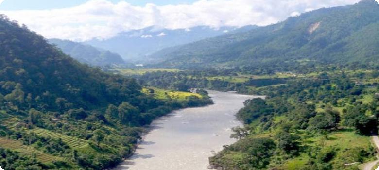
Later, we went to see the confluence of Saryu and Gomti.

Day 2 (18/7/1994) Pilgrims at the confluence of Saryu and Gomti
Sh. Rawal took us to the particular point of the confluence where one should take a holy dip.

Day 2 (18/7/1994), Confluence of Saryu and Gomti rivers
Mr Rawal alone went into the river and took the holy dip in the confluence. Rest of us enjoyed watching the confluence surrounded by green mountains.

Day 2 (18/7/1994), Mr Rawal, preparing to take a dip in the confluence
Chaukori
Bageshwar to Chaukori was a 50 km journey.
We stopped for our lunch at Chaukori, which is a hill station set among the lofty peaks of the Western Himalayan Range in the Kumaon Division of Uttarakhand and a prominent tourist place. From here one can have a wide and picturesque view of Himalayan range. Tourists coming to this place generally also visit the nearby tourist places like Patal Bhuvaneshwar, Bageshwar and Almora.
The KMVN rest house at Chaukori was well maintained.

Day 2 (18/7/1994), KMVN Rest House at Chaukori
After lunch, we strolled around the Rest house to see the Panchachulli peak. Unfortunately, it was cloudy and the peak did not oblige us. We came back thinking that we must make another visit to witness its grandeur.

Day 2 ( 18/7/1994) Surroundings of KMVN Rest House at Chaukori
Dharchula, Final destination for the day: 109 km from Chaukori
Evening tea was served at Thal. After that we passed the confluence of Swet Ganga and KaliGanga at Jauljibi on our way to Dharchula.

Day 2 (18/7/1994) Evening tea at Thal with the KMVN bus at background
We finally reached Dharchula around 5.15 P.M. Dharchula is situated at the bank of Kali River. It gets its name from ‘Darchyo’ and ‘la’; “Darchyo” is a white colored traditional holy flag and “la” is an honorific term. Later the word changed with time as Dharchula in India and Darchula in Nepal.
The camp site was not impressive at all. We were told that Nepal is separated from India by the Kali River at Dharchula. We went to see the Kali river bridge connecting India and Nepal.

Day 2(18/7/1994) Kali river at Dharchula
Once we came back to the camp site, all hectic activities started. The young medical officer, Dr Jagdish Chandra Mandal and two wireless officers introduced themselves stating that they will be with us till Gunji. The ponywala Kalyan Singh also arrived with his mule “Chandu” and informed me that they would be with me till Lipulekh.
There was power failure. Using our torch and candles, we packed our belongings inside water proof bags so as to make them ready for weighing. We were allowed to take maximum 20 Kg of baggage. Watching the weighing process was fun. I could not resist myself from sitting on that luggage weighing platform to weigh myself.

Day 2 (18/7/1994). Weighing of baggage at Dharchula camp